Please find below information on Planning Complex Cities graduation projects that have started in autumn 2021 and have been concluded in 2023. Click on project sub-titles to access the full graduation project reports at the TU Delft education repository.
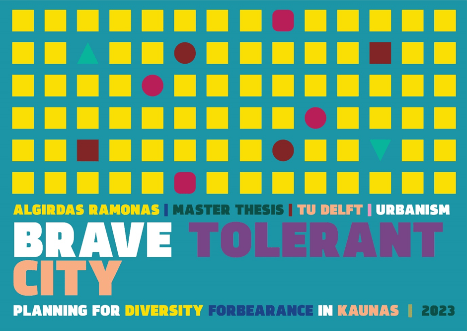
Algirdas Ramonas
Brave Tolerant City
Planning for diversity forbearance in Kaunas
Location: Kaunas, Lithuania
Mentors: Gregory Bracken, Juliana E. Goncalves
Keywords: tolerance, diversity, inclusivity, comity, affect
Tolerance is an essential tool of peaceful coexistence that allows diversity to flourish and a multicultural pluralist society to function. In times of globalisation, digitalisation, and polarization, it is becoming more critical than ever. Nevertheless, tolerance faces multiple issues. As a concept, it is being washed up, belittled, and critiqued either for its extensiveness or narrowness. Consequently, it became a vague notion, posing the question of what it means in contemporary society. Is it emotion, feeling, or attitude? How does it relate to other concepts of inclusivity and justice? In addition, even with an increasing amount of studies, there is still a gap in knowledge about the relationship between tolerance and space. It is still largely unknown how one associate with the other, what forces are affecting this link and how to use it to facilitate tolerance. Moreover, Kaunas, my hometown and choice as a case-study area, has very explicit issues regarding discriminatory but also changing attitudes, making it an optimal location to investigate (in)tolerance and conditions for it. Therefore in this paper I embark on a journey to study this concept, following the main research question: how can spatial and policy planning be used to foster more tolerant attitudes towards difference in everyday Kaunas?
Tolerance is subjective, partly non-representational, and unconscious. For this reason, I chose to use a mixed-methods explorative approach, combining comprehensive theoretical and empirical analyses. I consolidated spatial observations, institutional research, in-depth unstructured interviews, extensive literature and media review, and poetic investigation of artistic mediums. Through these methods, I integrated knowledge from a diverse range of disciplines, from psychology and philosophy to urban planning and architecture.
The fusion of multiple methods and disciplines allowed me to conclude on conceptual and spatial aspects of tolerance. By integrating tolerance into the affect theory, I argue that it is a process which, through encounter, transforms one state of being into another, meaning that tolerant attitudes are in constant flux. I transferred this new definition into the theoretical framework, which guided my empirical investigation in Kaunas. Based on unstructured interviews and an analysis of multiple cases, I uncovered a force affecting people’s attitudes in Lithuania – the Tolerance Event. It is a very active form of encounter that ruptures the passive status quo while at the same time addressing severe socio-cultural issues and allowing people to get to know diversity. Building on this theory, I propose multiple strategies as an example of how to use the Tolerance Event in Kaunas. They involve funding, policy, institutions, design, and planning proposals and are covered by one central vision – to become the Brave Tolerance City, Kaunas needs More Tolerance Events.
For more information on Algirdas: https://www.linkedin.com/in/algirdas-ramonas-a0b677127/

Andria Charilaou
Bodies of Antithesis
Gender power relations in conflict and militarized environments
Location: Cyprus
Mentors: Verena Balz, Leo van den Burg
Keywords: Gender inequality, conflict, militarism, institutionalized perspectives, visual ethnography
The thesis unveils and challenges institutionalized gender hierarchical relations between the military and women in conflict environments. It critically examines the military as an institution inherently intertwined with conflict in periods of war and during periods of conflict. The thesis argues that the military plays a significant role in shaping and maintaining gender power structures, through institutional perceptions and spatial practices. It explores the relationship between the military and women and how institutionalized gender perceptions contribute to the widening gap between them, using Cyprus as a case study. Through the use of visual ethnography as a primary methodology, the thesis seeks to shed light and challenge the oppressive prescript narratives and power dynamics imposed on women by the military.
Using Nicosia and Pyla as a case study, conflict environments where inhabitants have normalized the experiences of living with the constant presence of the military, the thesis spatializes its theoretical framework. It utilizes tools and insights gained from theoretical and artistic analyses, to make visible and challenge the gender institutional perceptions, fixed gender roles, and spatialities that feed gender hierarchical structures. The ultimate goal is to expose this issue in various existing and ongoing conflict environments.
For more information on Andria: https://www.linkedin.com/in/andria-charilaou/
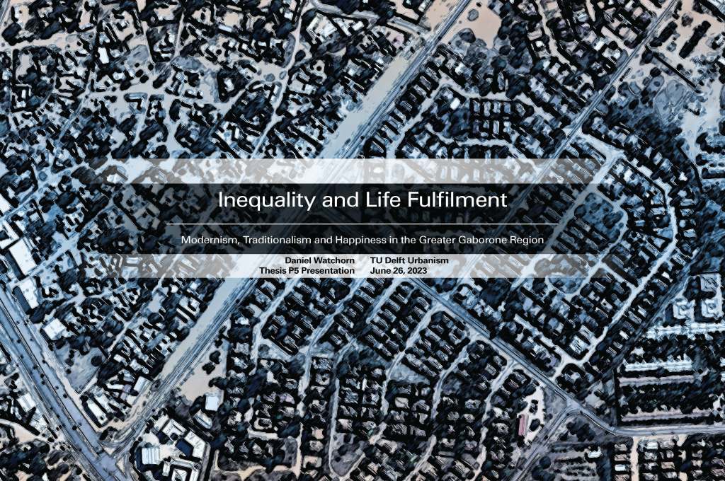
Dan Watchorn
Inequality and Life Fulfilment
A social, cultural and spatial exploration of the greater Gaborone region
Location: Gaborone, Botswana
Mentors: Roberto Rocco, Maurice Harteveld
Keywords: Life fulfilment, cultural philosophy, spatial inequality, capabilities approach, economic inequality
The story of modern Botswana is that of dualities. At the time of independence in 1966, it was the second poorest country in the world in terms of GDP. Since then, it has seen explosive economic growth and accompanying improvements in human development. It is now ranks third in sub-saharan Africa in both GDP per capita and HDI. This impressive record, however, does not tell the full story. Botswana is the 10th most economically unequal country in the world and is ranked 132nd out of 137 surveyed countries in the World Happiness Report.
This project explores the relationships between the urban system, inequality and life fulfilment by analyzing the spatial and societal systems active both in the present day and in the traditional/pre-colonial era. An anthropological and philosophical lens is used throughout the analysis in order to distil the value systems that have underpinned life in these different historical eras. These value systems, in turn, reveal the perspective through which people have been experiencing their environments, which helps to explain why this concept of life fulfilment inequality is present here. There is a clear disconnect between the cultural and historical makeup of society in Botswana and the modern systems, spaces and institutions which govern everyday life.
Thirteen principles for a new urban system are then proposed, which when taken together, attempt to define a system which prioritizes economic/socio-spatial equity and the maximization of life fulfilment. Design demonstrations are created to imagine how these principles could be translated into space.
For more information on Dan: https://www.linkedin.com/in/daniel-watchorn-554360136/
Daniëlle Lens
Roadmap to Belonging
Location: Hardenberg & Dalfsen, the Netherlands
Mentors: Caroline Newton, Juliana Goncalves
Keywords: Sense of belonging, social integration, cultural identity, economic integration, Syrian status holders
Forced migration has been a significant struggle in the Netherlands, politically, socially, spatially and culturally. The costs of this struggle are paid by asylum seekers and status holders, living in uncertainty and isolation. This thesis discusses the position of Syrian status holders in the Netherlands, refugees who have obtained a residency permit to stay in the Netherlands.
The aim of this thesis is to explore which role small towns play in the integration of Syrian status holders. A hypothesis was formulated that formed the basis for the fieldwork. The fieldwork consisted of site visits to two towns: Hardenberg and Dalfsen and interviews with Syrian status holders. The fieldwork provided opportunities and lessons that informed the final results.
The result of this thesis is a roadmap to belonging: an overview of the factors: places, identifications, policies and collaborations, that influence the sense of belonging of Syrian status holders. A sense of belonging is defined by three dimensions: economic integration, social integration and the expression of cultural identity. Three catalysts are proposed to showcase how combining different factors results in complicated but effective strategies to improve the sense of belonging of Syrian status holders, while also offering opportunities to the host community. The catalysts concern employment, entrepreneurship, social interaction and leisure activities. This thesis provides a new view on the accommodation of newcomers, where benefits for the local society are synergized with a welcoming home for Syrian status holders.
For more information on Daniëlle: www.linkedin.com/in/daniëlle-lens-7694811bb
Larissa Müller
Permeating Socio-Ecological Walls
Addressing the multi-dimensional inequality in the ‘City of walls’ through environmental justice
Location: Metropolitan Region of São Paulo, Brazil
Mentors: Roberto Rocco, Claudiu Forgaci
Keywords: Environmental justice, vulnerable communities, socio-ecological systems, city of walls, socio-spatial segregation
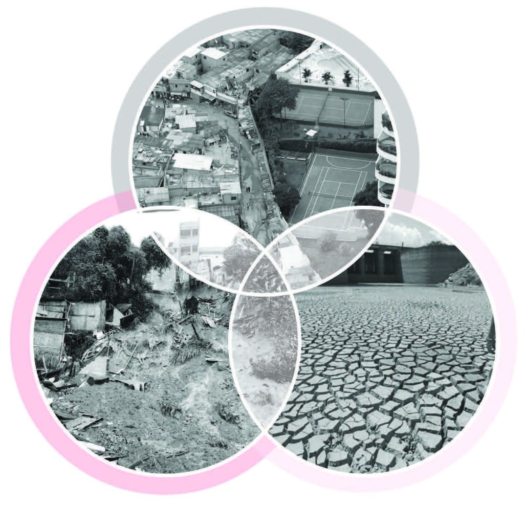
São Paulo’s socio-spatial segregation and fragmentation transverses institutional, economic, spatial, social, and environmental levels, granting it the nickname of the ‘City of Walls’. The increase in discrimination and inequality, due to a lack of governance and unbalanced urban planning, has resulted in a society exposed to extreme, multi-dimensional inequality. Rapid urbanization coupled with market-oriented development, governmental neglect, discrepancies between formal and informal systems within the city, and socio-spatial segregation has widened the gap between social groups within the city. These processes have shaped the multidimensional fragmentation within the city, creating walls transcending the just physical realm and manifesting as walls in planning processes and in the distribution of resources and opportunities. In addition, global pressures resulting from climate change and the degradation of ecological systems within the region further expose marginalized communities to increasing risks.
In today’s globalized world, with rapid urbanization coupled with climate change, cities need to transition to a more sustainable and adaptive future. However, in a society with blatant socio-economic inequality, marginalized communities become disproportionately affected and left behind. Addressing these socio-environmental inequalities requires the establishment of a foundation of ecological integrity, ensuring a high standard of liveability and an environment of inclusivity for marginalized communities. Thus, this research proposes the reconfiguration of the Metropolitan Region of São Paulo through socio-ecological strategies aimed at restoring ecological integrity, promoting social inclusivity, and empowering local communities. With the support of a strategic vision aimed at distributing environmental justice, this project also proposed strategic actions throughout the metropolis that manifest at a more local scale in vulnerable areas to explore these relationships in a more grounded and spatialized context. Through creating a network of environmental systems aimed at expanding benefits to all social groups, these outcomes will consequently act as a bridge in the ‘City of Walls’ and reverse patterns of vulnerability and inequality in São Paulo.
For more information on Larissa: https://www.linkedin.com/in/larissa-m-muller/
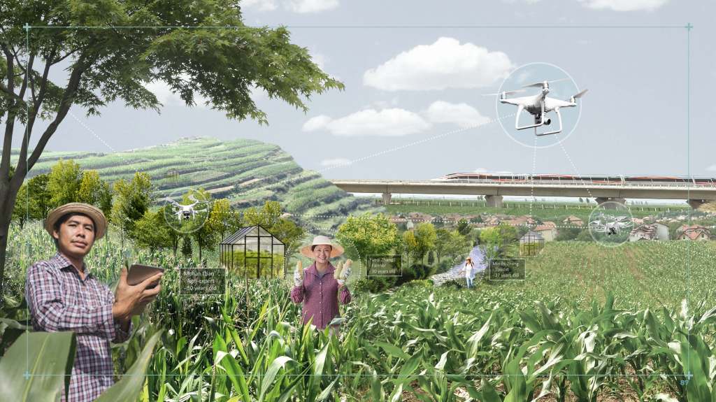
Minshi Zhang
Smart Villages
Rural revitalisation strategies based on Taobao Village development model in rural areas of GBA
Location: Greater Bay Area, China
Mentors: Lei Qu, Steffen Nijhuis
Keywords: Sustainable revitalisation, spatial strategies, agricultural upgrading, rural liveability, digitalisation
China’s rapid urbanisation and industrialisation seriously impacted rural areas, which is reflected significantly in the Greater Bay Area. With globalisation and digitalisation, the emergence of Taobao villages has become a new model for rural development in China. However, socio-economic activities entering in Taobao villages with digital technology were unguided and lacked spatial planning. Consequently, the pursuit of economic growth has resulted in the sacrifice of agricultural resources, degradation of the ecological environment, and terrible spatial quality. With the regionalisation and integration of the Greater Bay Area, the need for sustainable rural revitalisation has become urgent.
To envision future possibilities for rural development, this project introduces the concept of Smart Villages, aiming to enhance agricultural productivity and improve rural liveability. With the Dutch layer approach as the main methodology, the project understands the essential resources that support smart village development and evaluates the spatial conditions of rural areas at regional, district, and local scales. To conclude, the key design elements for Smart Villages development include agricultural agglomeration, accessible networks, and rural liveability. Based on these findings, the project proposes a potential Smart Villages development framework that serves as a guide for rural areas. A series of spatial design strategies are also presented and applied to two design cases, Xingtan in Foshan and Chikan in Jiangmen. They represent rural areas at different levels of development, showcasing scenarios of agro-industrial and eco-agricultural development respectively. It demonstrates how rural areas make use of local resources to spontaneously develop into Smart Villages, thereby reducing dependence on urban centres and contributing to the development of metropolitan regions.
The project highlights the need for a flexible approach to rural revitalisation in the digital future. By embracing the concept of Smart Villages, it advocates for sustainable agricultural practices, improving infrastructures, and enhancing the quality of life for rural communities. The proposed framework and design strategies offer valuable insights for planners, policymakers, and stakeholders seeking to foster the sustainable development of Smart Villages in a spatial perspective.
For more information on Minshi: https://www.linkedin.com/in/minshi-zhang-b39985241/
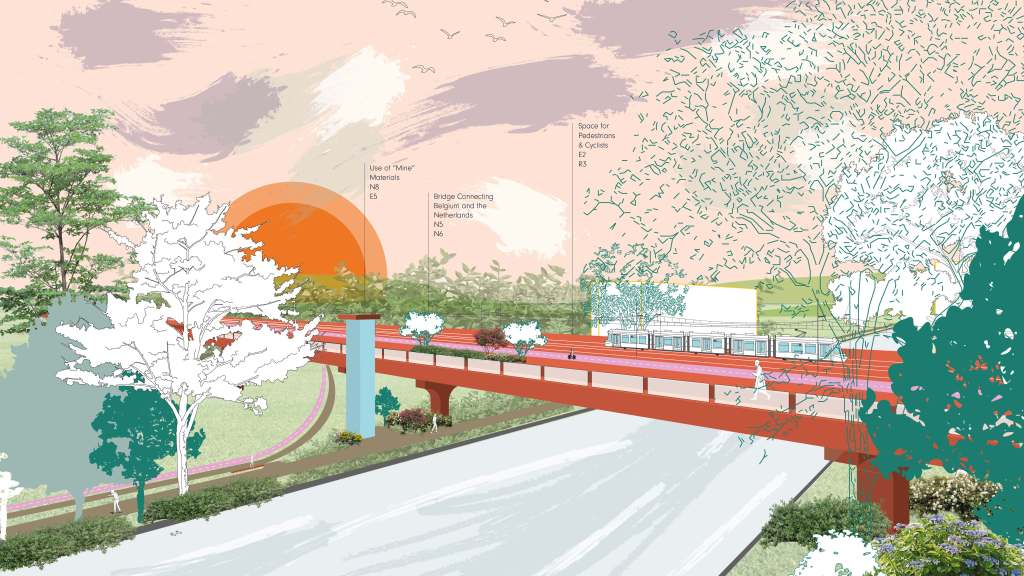
Thomas van Daalhuizen
Reconfiguring Travel Patterns
The necessary rapid just transition to car-free urban planning in a cross-border context
Location: Mining district of Dutch and Belgian Limburg
Mentors: Roberto Rocco, Victor Muñoz Sanz
Keywords: Transition strategy, mobility planning, sustainable mobility, social sustainability, transportation networks, cross-border
There is a need to broaden discussions on sustainable mobility beyond electric cars and address the challenges faced by border regions and marginalised groups dependent on public and soft transport. This thesis explores how a transition strategy can support the creation a just and sustainable multi-modal network in a cross-border context. The provinces of Limburg and the mining district are used as a case study. Valuable insights are derived from comprehensive analyses, contributing to a holistic strategy for the region.
Key findings emphasise the role of garden cities in shaping the strategy, connecting neighbourhoods and promoting mobility alternatives. Improving public transport connections within the mining region is crucial for reducing car dependency and generating positive impacts. Collaboration among stakeholders is essential due to the lack of cross-border connections and administrative barriers. Repurposing the old mine infrastructure offers a transformative opportunity to establish a sustainable transport system. The envisioned future sees opportunities for the old mining infrastructure to act as a multi-modal transport backbone, integrated with multiple garden cities for enhanced connectivity and community. A pattern language approach guides the strategy-making process, tested through a workshop simulation. Policy recommendations stress cross-border collaboration, flexibility, co-creation, and data sharing. By following these recommendations, the region can achieve a just and sustainable multi-modal network, fostering regional integration, equal opportunities, and access to resources.
For more information on Thomas: https://www.linkedin.com/in/thomasvandaalhuizen/
Other students who have graduated in the summer of 2023 are:
Anyi Yan
Self-Salvation beyond Growth
Research on urban regenerative planning for resource-exhausted cities in socio-economic transition from smart shrinkage perspective
Mentors: Rodrigo Cardoso, Claudiu Forgaci
Location: Hegang, China
Chloe Huang
Adaptive Regeneration of Urban Villages
Shenzhen in the context of rapid urbanization
Mentors: Lei Qu, Birgit Hausleitner
Location: Shenzhen, China
Fran Shen
Re-imagining Periphery
On identifying development opportunity of North Anhui through place-based circular transition
Mentors: Marcin Dabrowski, Birgit Hausleitner
Location: North Anhui, China
Francien Fons
The Gender Reveal of Space
A spatial strategic framework for a more gender inclusive planning and design of public spaces in the Netherlands
Mentors: Reinout Kleinhans, Els Bet
Location: Rotterdam, The Netherlands
Jasmine Bacani
The Urban Dormitory
Reducing the negative consequences of studentification in small-sized university cities
Mentors: Rodrigo Cardoso, Els Bet
Location: Delft, The Netherlands
Jiaying Wu
The Power of Imperfection
China-Ethiopia industrial parks as the medium for local vitalization: the case of Eastern Industry Zone, Dukem, Ethiopia
Mentors: Gregory Bracken, Claudiu Forgaci
Location: Dukem, Ethiopia
Ke Zhou
Feeding the Future
Towards a climate resilient rice production in the Mekong Delta of Vietnam
Mentors: Marcin Dabrowski Inge Bobbink
Location: Mekong Delta, Vietnam
Kuan-Ting Liu
From Energyscape To Energy Justice
Rethinking approaches for a just energy transition / revitalize the neglected regions through integrated planning: a case study in Changhua, Taiwan
Mentors: Marcin Dabrowski, Ulf Hackauf
Location: Changhua, Taiwan
Mia Zhao
From Peril to Promise
Towards a Socially Resilient Urban Village, the Case of Dongguan
Mentors: Gregory Bracken, Marco Lub
Location: Dongguan, China
Nora Anders
Someone at Home?
An integrated housing system that utilises vacancy in London for temporary housing to ensure homes for low-income families
Mentors: Verena Balz, Ana Petrović
Location: London, UK
Shinnosuke Wasswa
(Re)framing the Narrative
Storytelling otherwise for a just forest economy in Kampala’s city region
Mentors: Caroline Newton, Victor Munoz Sanz
Location: Kampala, Uganda
Siene Swinkels
Reframing Brussels’ Canal Zone
From path dependence to path renewal
Mentors: Rodrigo Cardoso, Birgit Hausleitne
Location: Brussels, Belgium
